About KASI Aviation
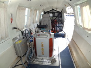
Kasi Aviation has been proud to offer the world first class aerial survey and mapping services since 2008 with our meticulously maintained fleet of Piper Navajo aircraft. Our crews are experienced in survey operations and deliver impressive quality work with a very economical timeline. Offering geophysical, LiDAR (with state of the art mapping equipment), and aerial photo you can trust that KASI understands survey. Because of this, we will strive to meet the needs of our clients and deliver the best value. The twin engine Navajo aircraft’s stability and versatility can help with testing and installation of equipment. We are available for worldwide work in gravity, low level survey, gravity, LiDAR, Bathymetric LiDAR, photography and other work. Give us a call or email to find out how KASI can help you out with some of the most professional survey flying in the business.
Examples of the types of equipment that KASI Aviation aircraft can be equipped with:
- Magnetometer
- Spectrometer
- Gravity Meter
- VLF-EM System
- LiDAR/ALTM
- Bathymetric LiDAR
- Digital/Ultracam
- Hyperspectral
Our Aircraft
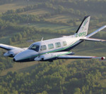
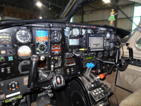
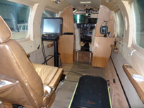
 Piper Navajo PA31
Registrations: C-GKSI, C-GKSX, C-GMEC and C-FXCI
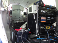
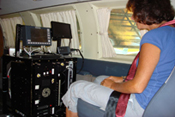
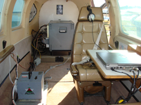
KASI Aviation Services Inc. operates four PA31 Piper Navajos. Our aircraft can be dedicated or modified specifically for your geophysical or photo survey project, and have been carefully put together to minimize aircraft induced magnetic noise. Our first aircraft, C-GKSI, can provide an exceptionally low figure of merit of less than 0.6 nT (as measured to the standards of the Geological Survey of Canada).
In 2015, with our first two aircraft fully booked and calls for more, KASI acquired an additional PA31 Navajo aircraft to meet the growing demands of our customers. C-GMEC came online early in July 2015 with a 21″ camera hole and long range fuel atop its list of modifications. Furthermore, again due to increasing demands for LiDAR; Bathymetry & Airborne Camera operations, in 2017 we added a fourth PA31 Navajo to our fleet. C-FXCI is modified & ready to go with a 21″ x 21″ along with 2 – 10″ x 12″ camera ports, suitable for a wide variety of Camera or LiDAR installations, simultaneously.
All of KASI Aviation’s aircraft can be customized for the most intricate Airborne surveys, LiDAR or Airborne photo operations.

Clients
KASI Aviation has often had the pleasure of working with:
Tundra Airborne Surveys, Tundra Airborne Surveys.
Airborne Imaging Inc. – a Clean Harbors company, http://airborneimaging.ca/
GeoPhysics GPR International, http://geophysicsgpr.com/en/
IIC Technologies, http://www.iictechnologies.com/
ITRES Research Ltd, http://www.itres.com/